



Heaviest rainfall expected Tuesday and Wednesday nights; forecasters also monitoring potential severe storms.
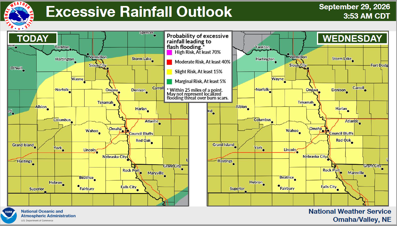
A prolonged period of heavy rain could bring flooding to Lincoln and much of eastern Nebraska this week, with the National Weather Service forecasting widespread rainfall totals of two to four inches and isolated amounts exceeding five inches.
A Flood Watch takes effect at 7 p.m. Tuesday and continues through 7 p.m. Thursday. Forecasters say tropical moisture associated with former Hurricane Polo is moving into the central United States, creating unusually wet conditions for late September.
National Weather Service meteorologist Jesse Castillo told KLIN News Tuesday morning that the exact location of the heaviest rainfall remains uncertain.
“We’re still uncertain on where that heaviest corridor totals will fall,” Castillo said, explaining that recent forecast guidance has shifted the heaviest rain north and south.
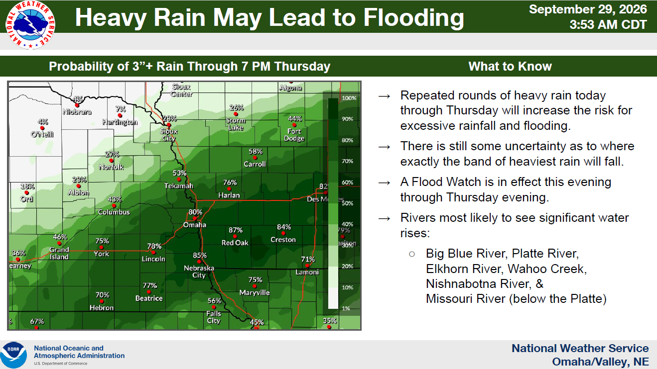
The latest forecast identifies a corridor extending from the York area southeastward with a substantial chance of receiving at least 3 inches of rain through Thursday evening. Castillo said probabilities range from approximately 50 to 85 percent in the areas of greatest concern.
9-29-26 NWS DssPacket
Two periods of heavy rainfall
Rainfall is expected in multiple rounds, with the heaviest rates forecast late Tuesday night and again Wednesday night.
For Lincoln, Castillo identified two primary windows of concern: after approximately 9 p.m. Tuesday through 6 to 9 a.m. Wednesday, and from approximately 6 p.m. Wednesday through 6 a.m. Thursday.
The National Weather Service expects rain to taper off Thursday afternoon, although the Flood Watch remains in effect through Thursday evening.
River flooding possible
Forecasters say saturated ground, combined with repeated rounds of heavy rain, could cause significant rises on several eastern Nebraska rivers. Minor river flooding is possible, while localized flash flooding could occur where the heaviest rain develops.
The rivers and waterways identified in the NWS briefing include the Big Blue, Platte, Elkhorn, Wahoo Creek, Nishnabotna and Missouri River downstream from the Platte.
Motorists should avoid driving through flooded roadways, particularly during overnight hours when water depth can be difficult to judge.
Severe storm threat Wednesday
There is also a conditional risk of severe thunderstorms Wednesday afternoon and evening, mainly southwest of a line extending from Seward to Beatrice. The National Weather Service’s morning briefing places that risk at five percent, with the possibility that the threat area could shift farther into southeast Nebraska.
Castillo said the development of stronger thunderstorms will depend largely on whether sufficient clearing allows the atmosphere to become unstable. Strong wind gusts and large hail would be the primary severe-weather hazards, in addition to flash flooding.
Residents should monitor changing forecasts and have multiple ways to receive weather warnings.
For updated forecasts and warnings, visit the National Weather Service Omaha/Valley office or the Lincoln forecast page.