


UPDATE 7:30 AM
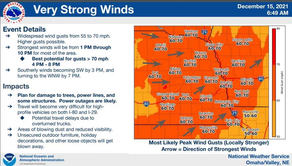
The National Weather has issued updated information including wind gust estimates and timings for today’s weather event.
The complete NWS release can be accessed here 12-15-21 IDSS_Packet_-_NWS_Omaha
High Wind Warning
A High Wind Warning is in effect from Noon Wednesday through 9 PM Wednesday evening. The strongest winds are expected to arrive by noon and beyond.
An intense storm system will move through the region today. Widespread wind gusts of 50 to 70 mph are likely, with potential peak gusts of 75 mph. A few severe storms and dangerous fire weather conditions are also possible Wednesday afternoon. Areas of blowing dust may also occur with reduced visibility.
Thursday – Strong winds and dangerous fire conditions will linger into the evening and then improve shortly after midnight.
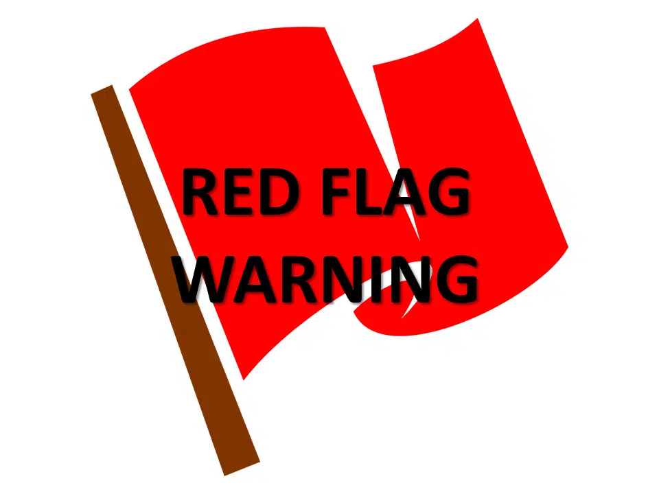
Red Flag Warning
…RED FLAG WARNING REMAINS IN EFFECT FROM NOON TODAY TO 9 PM CST THIS EVENING FOR WIND AND LOW RELATIVE HUMIDITY FOR SOUTHEAST NEBRASKA AND SOUTHWEST IOWA…
* Affected Area…In Iowa, Pottawattamie, Mills, Montgomery, Fremont and Page. In Nebraska, Butler, Saunders, Douglas, Sarpy, Seward, Lancaster, Cass, Otoe, Saline, Jefferson, Gage, Johnson, Nemaha, Pawnee and Richardson.
* Winds…Southwest 30 to 40 mph with gusts up to 70 mph.
* Relative Humidity…dropping to the 15 to 25 percent range.
* Impacts…Any fires that ignite will spread rapidly and exhibit extreme behavior. Outdoor burning is not recommended.
If fires develop, be prepared for a wind shift from the south to the southwest and then to the west.
PRECAUTIONARY/PREPAREDNESS ACTIONS…
A Red Flag Warning means that critical fire weather conditions are expected. The combination of strong winds, low relative humidity and warm temperatures can contribute to extreme fire behavior.