


A myriad of weather conditions will present through midweek in the Lincoln area with near-record warmth today and blizzard conditions forecast midweek.
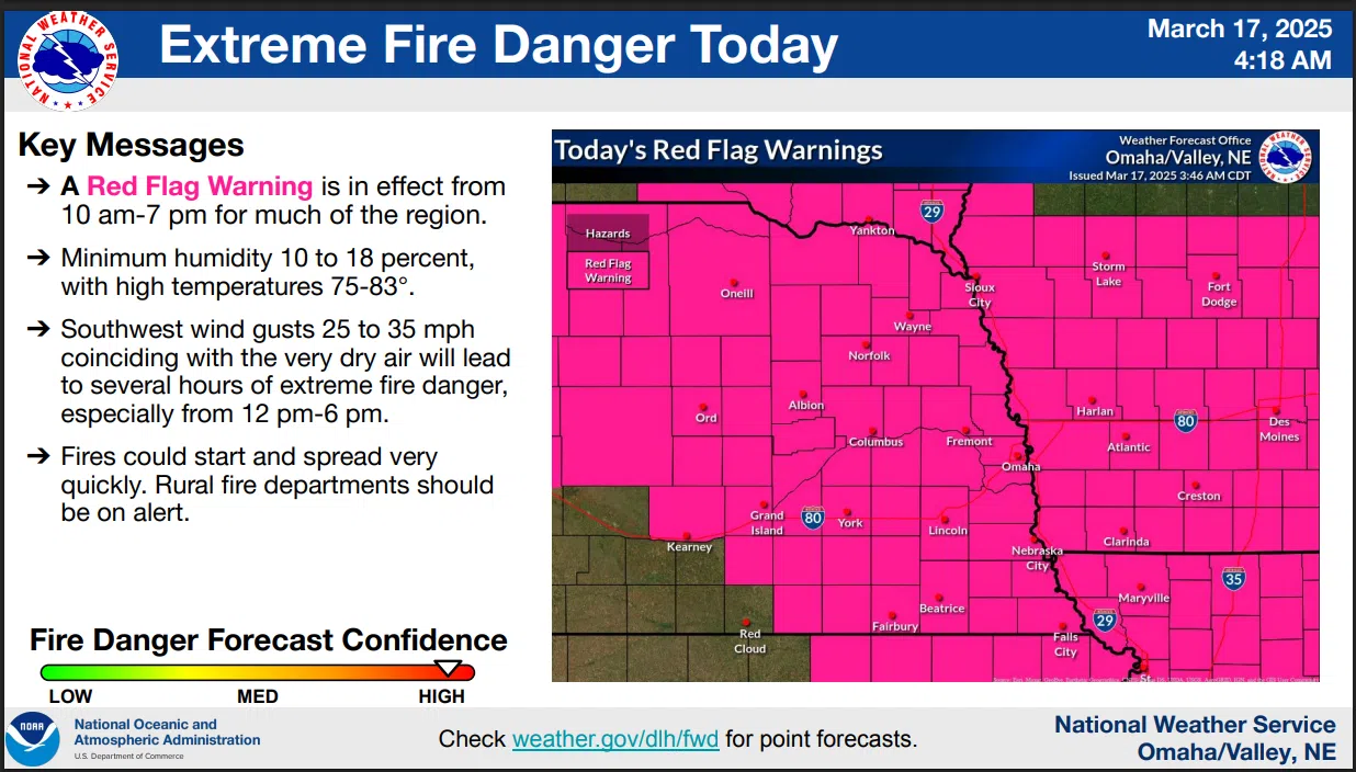
Today’s forecast high of 83 degrees would be 1 degree short of the record set in 1894. With the warmth and strong winds plus abundant fuels sources due to recent drought conditions has prompted the issuance of a RED FLAG WARNING from 10 am to 7 pm today.
National Weather Service Meteorologist Corey Mead told KLIN News similar conditions Tuesday could lead to another alert ahead of an approaching strong winter storm expected to arrive in the area Tuesday evening.
There is a possibility of severe thunderstorms developing during the transition period late Tuesday afternoon. After the storm moves out late Wednesday night more seasonable weather is expected.
Here is the latest NWS Information:
3-17-25 NWS
…RED FLAG WARNING IN EFFECT FROM 10 AM THIS MORNING TO 7 PM CDT THIS EVENING FOR WIND AND LOW RELATIVE HUMIDITY FOR EASTERN NEBRASKA AND SOUTHWEST IOWA…
* WINDS…Southwest 10 to 20 mph with gusts up to 35 mph.
* RELATIVE HUMIDITY…As low as 11 percent.
* IMPACTS…Any fires that develop will likely spread rapidly. Outdoor burning is not recommended.
A Red Flag Warning means that critical fire weather conditions are either occurring now or will shortly. A combination of strong winds, low relative humidity and warm temperatures can contribute to extreme fire behavior.
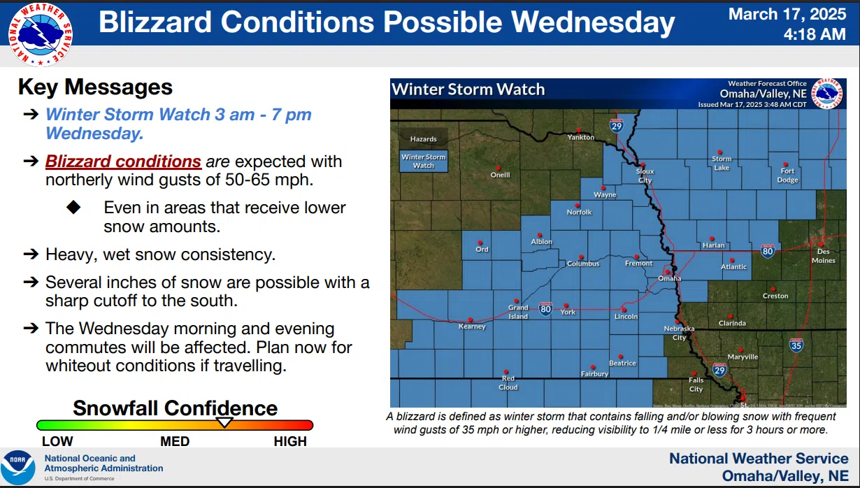
…WINTER STORM WATCH REMAINS IN EFFECT FROM LATE TUESDAY NIGHT THROUGH WEDNESDAY EVENING…
* WHAT…Blizzard conditions possible. Total snow accumulations two to six inches possible. Winds could frequently gust 50 to 60 mph.
* IMPACTS…Visibilities may drop below 1/4 mile due to falling and blowing snow, with whiteout conditions possible at times. The strong winds and weight of snow on tree limbs may down power lines and could cause sporadic power outages.
Additional details are available here 3-17-25 NWS AM DssPacket (1)