


…RED FLAG WARNING REMAINS IN EFFECT UNTIL 8 PM CDT THIS EVENING FOR WIND AND LOW RELATIVE HUMIDITY FOR SOUTHEAST NEBRASKA AND SOUTHWEST IOWA…
* WINDS…South 20 to 30 mph with gusts up to 45 mph.
* RELATIVE HUMIDITY…As low as 19 percent.
* IMPACTS…Any fires that develop will likely spread rapidly.
Outdoor burning is not recommended.
…WIND ADVISORY IN EFFECT FROM 1 AM TO 1 PM CDT SATURDAY…
* WHAT…Northwest winds 25 to 35 mph with gusts up to 50 mph expected.
* IMPACTS…Gusty winds will blow around unsecured objects. Tree limbs could be blown down and a few power outages may result.
Winds this strong can make driving difficult, especially for high-profile vehicles. Use extra caution if you are traveling.
3-14-25 NWS Midday
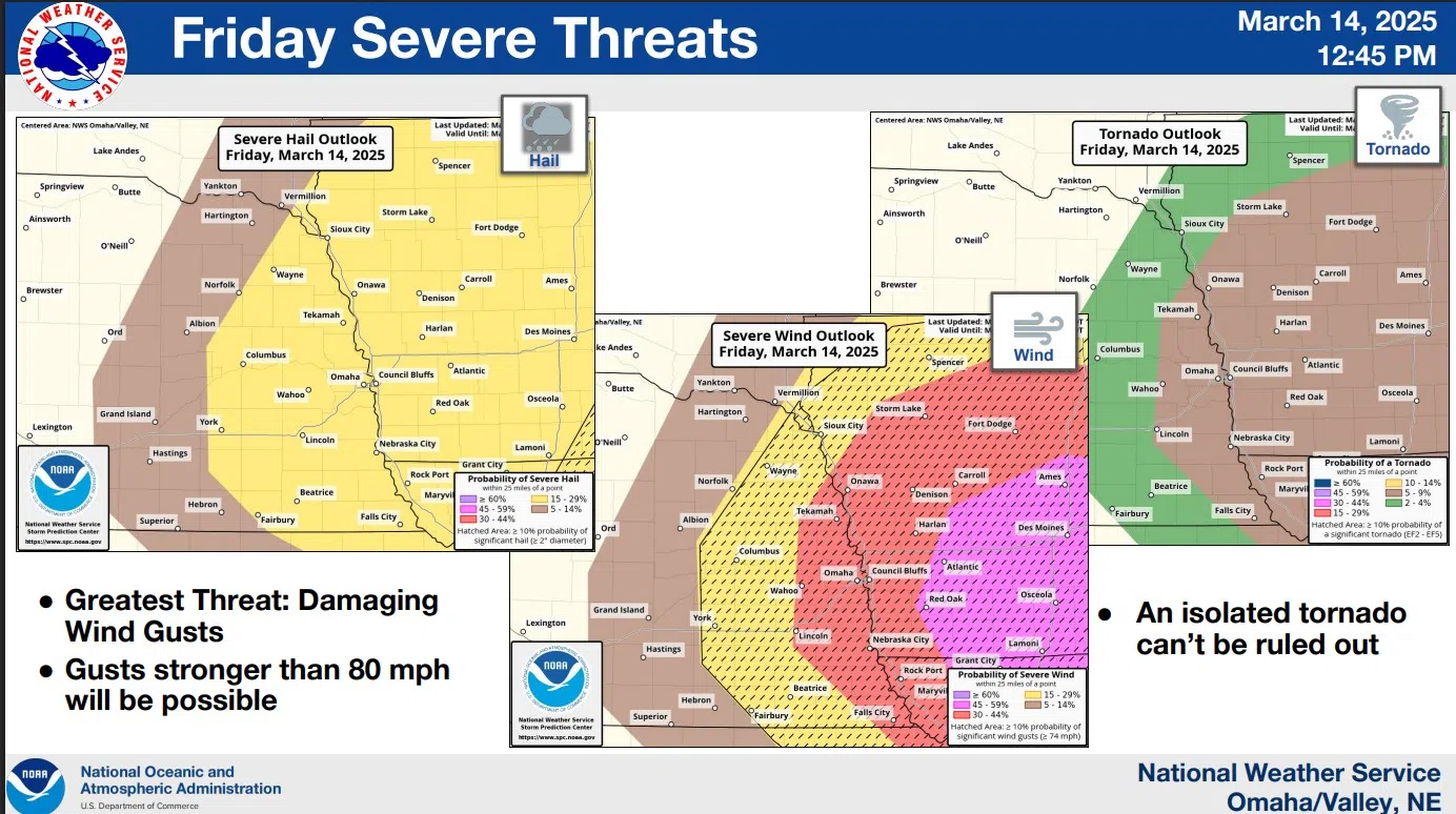
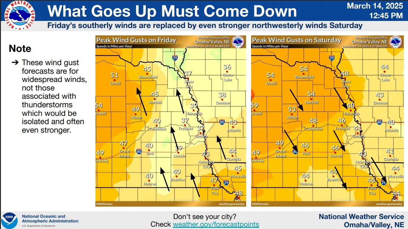
An intense weather system will move through the area today into Saturday with strong Southerly winds with gusts of 30 to 45 mph today that will switch to the Northwest at 45 to 60 mph late tonight into Saturday.
There is a 30-50 percent chance for severe storms this afternoon mainly between 3 and 7 PM. The main threat with the severe storms will be damaging winds with the potential for gusts up to 75 mph, and hail up to one inch in diameter.
An isolated weak tornado could also occur. Severe storms should initially develop along the Kansas and Nebraska border and then shift northward through the afternoon into the early evening.
If severe storms, develop the immediate threat should only last about 15 minutes at any given location because the storms are expected to be fast-moving.
Rain will switch over to snow early Saturday morning, with up to an inch of snow expected in northeast Nebraska by noon Saturday. Regardless of snowfall amounts, any snow combined with the strong winds will lead to very poor visibility with blowing snow and potential travel impacts.
The full, detailed summary from the National Weather Service in Valley is available here or 3-14-25 NWS PM DssPacket