


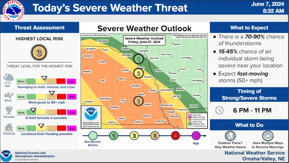
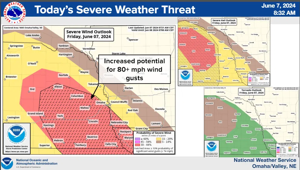
 Strong to severe thunderstorms will develop in northern Nebraska by mid to late afternoon, and move across parts of eastern Nebraska and southwest Iowa through the evening. The strongest storms may produce areas of significant damaging wind and hail, flash flooding, and a chance for a few brief tornadoes.
The greatest chance for severe weather is southwest of a line from Niobrara to Norfolk to Omaha to Clarinda…between 6 PM and 11 PM. The greatest chance for isolated flash flooding is generally along or just south of this line.
Access to the latest severe weather details is available here
Key Points from a National Weather Service Public Safety and Media Webinar late morning:
Storms will be fast-moving storms – 50+ mph which means warning lead times may be shorter than normal
Large hail is expected with ‘wind driven hail’ possible with wind gusts of 80+ mph
Lincoln time-line for storm development 5p-11p—Peak Time 8:30-9pm