


NWS 3-1-26
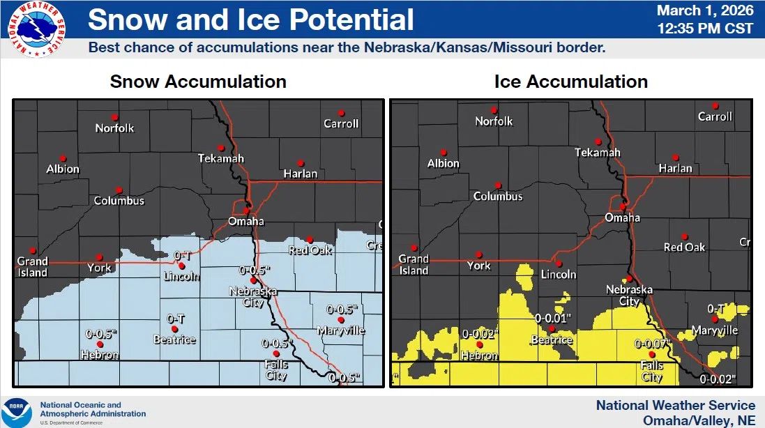
The latest weather outlook from the National Weather Service includes light snow forecast to move in Sunday afternoon into Sunday night (40-70% chance), mainly south of I-80, with accumulations of a dusting up to one inch are possible.
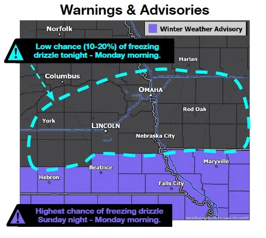
Freezing drizzle is expected to mix in Sunday night into early Monday morning, with the it and the snow combining for slick roads as temperatures cool.
Temperatures will trend warmer late Monday afternoon through much of the week, which should keep any additional precipitation as rain Tuesday and Thursday.
Another system is expected Friday into early Saturday with added chances of rain.
Sunday midday details from the National Weather Service are available here 3-1-26 NWS PM DssPacket