


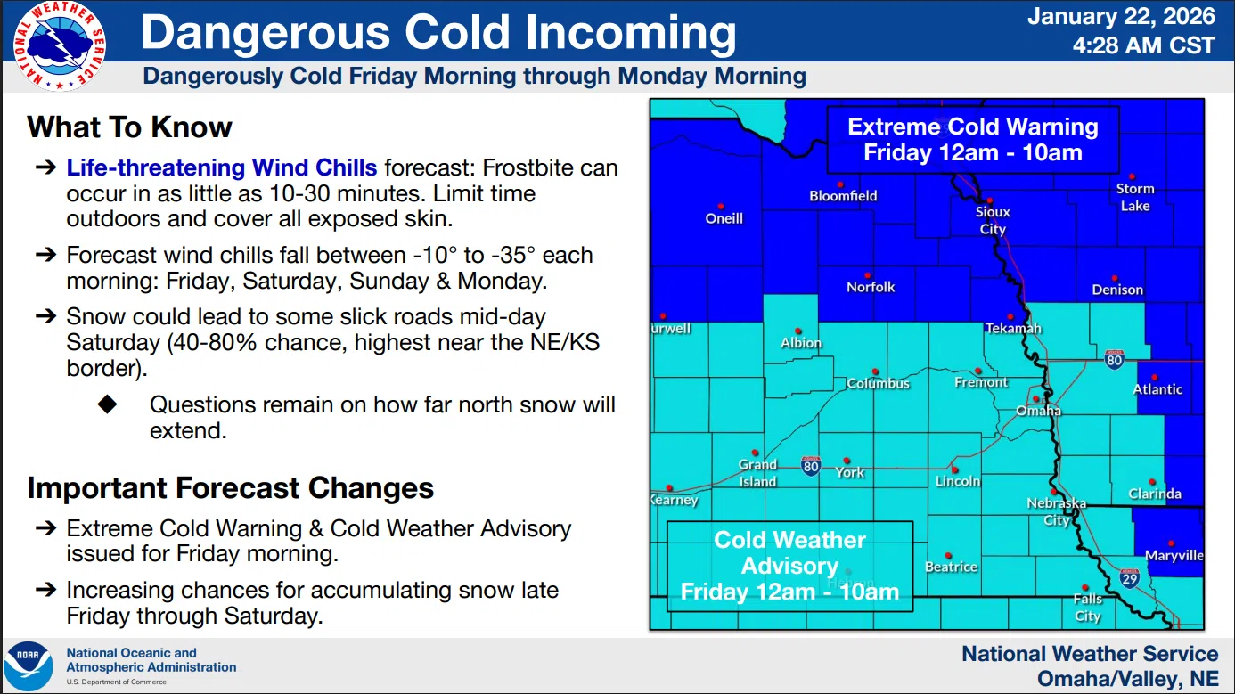
Temperatures will drop quickly this evening as a dangerous cold front moves into the area. Tonight into early Friday, sub-zero temperatures are expected with wind chill values expected to reach 20 to 35 degrees below zero.
The dangerous cold is expected to continue through Monday morning with wind chills each morning as low as 20 degrees below zero.
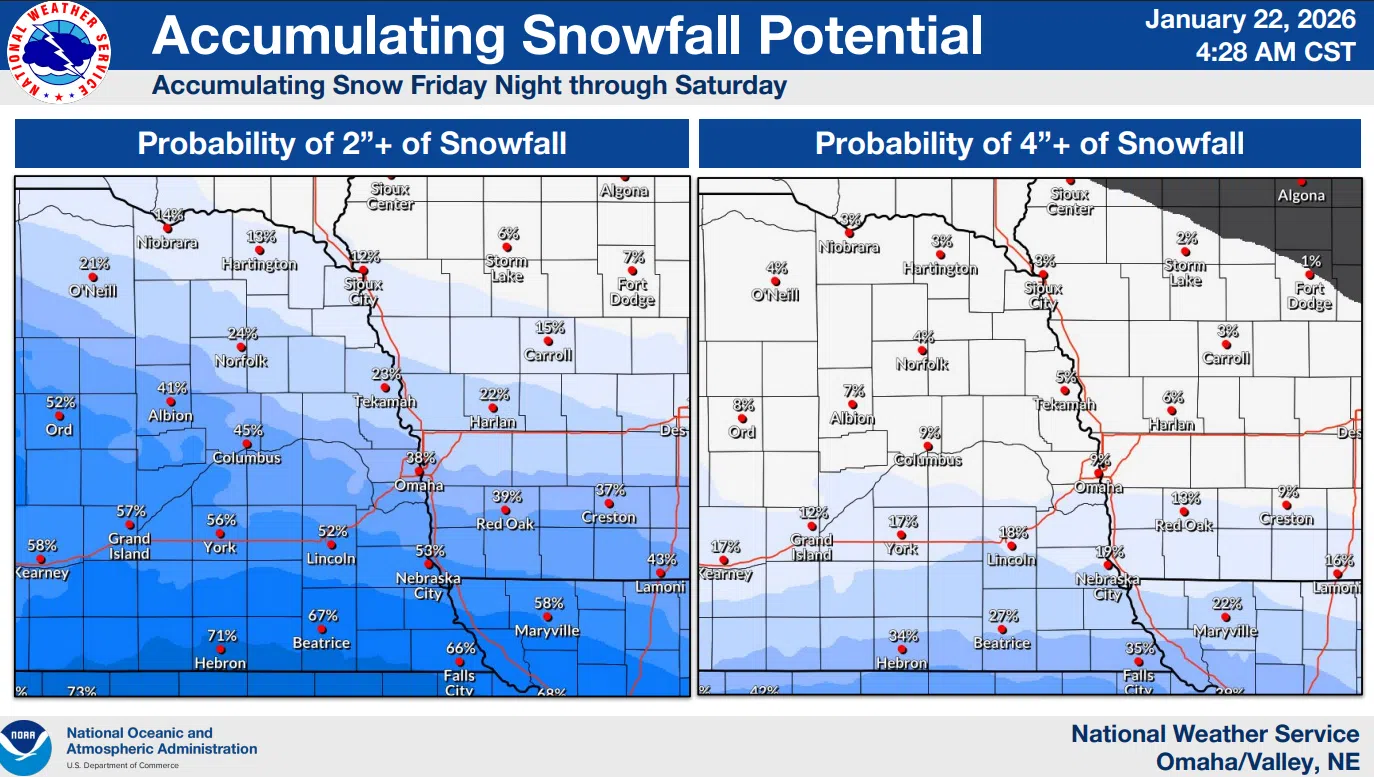
The latest outlook includes a 60 to 80 percent chance of snow moving into the area Friday afternoon through Saturday. Snowfall totals are expected to peak in the 2 to 4-inch range in southeast Nebraska and southwest Iowa, with totals decreasing northward.
NWS
…COLD WEATHER ADVISORY IN EFFECT FROM MIDNIGHT TONIGHT TO 10 AM CST FRIDAY…
The dangerously cold wind chills as low as 28 below zero could cause frostbite on exposed skin in as little as 30 minutes.
Frostbite and hypothermia will occur if unprotected skin is exposed to these temperatures.
Use caution while traveling outside. Wear appropriate clothing, a hat, and gloves.
Make frequent checks on older family, friends, and neighbors. Ensure portable heaters are used correctly.
The latest NWS Info is available here 1-22-26 NWS AM DssPacket