


NWS
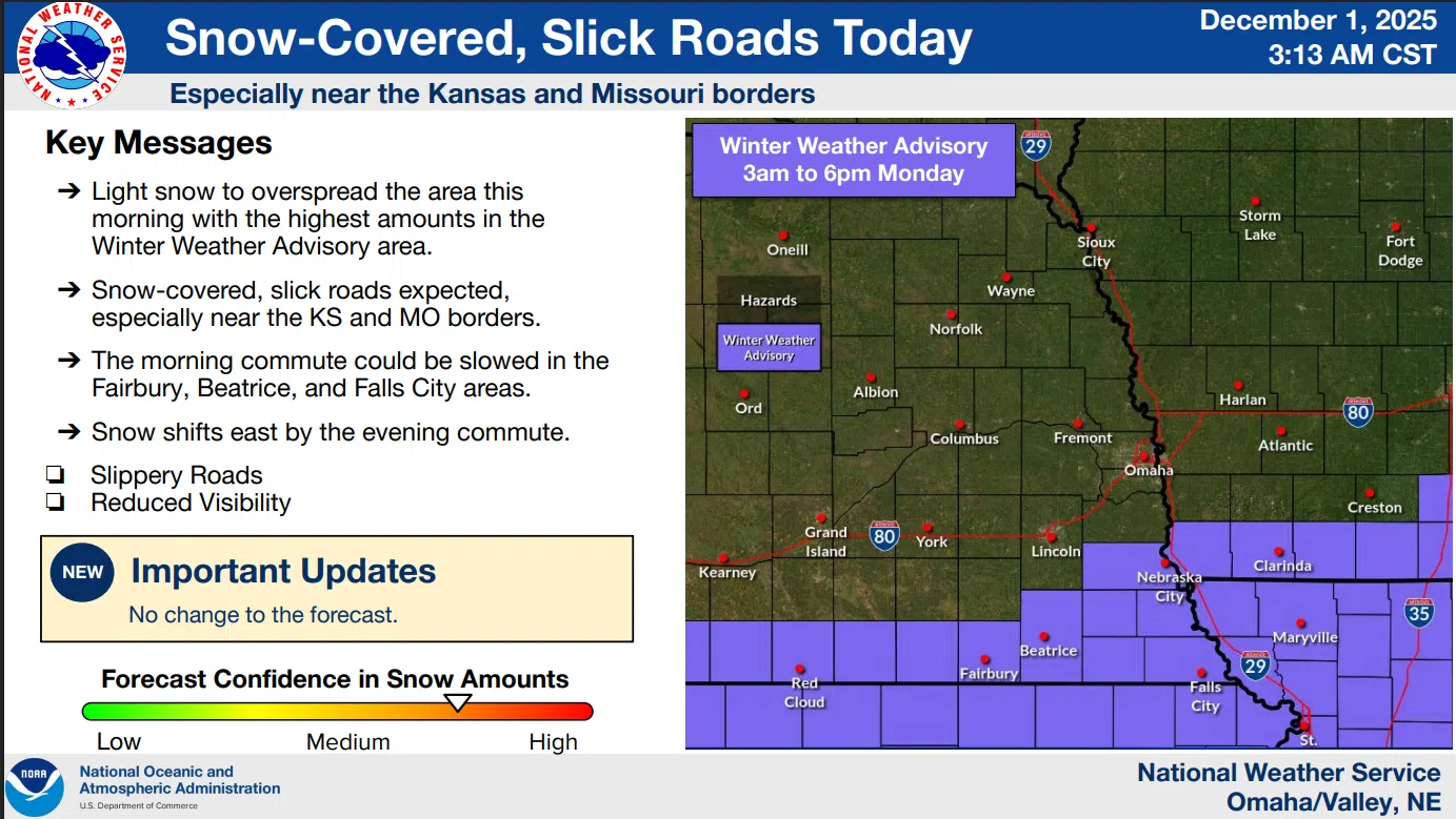
Light snow will fall across southeastern Nebraska and southwestern Iowa through early this evening. Visibility may slip below three miles at times. Snow-covered roads will become slick.
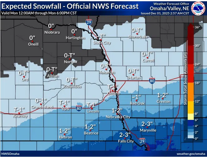
As snow wraps up from west to east on Monday, one to four inches of accumulation will be possible, primarily across southeast Nebraska and southwest Iowa.
…WINTER WEATHER ADVISORY REMAINS IN EFFECT UNTIL 6 PM CST THIS EVENING…
For Fremont-Page-Otoe-Jefferson-Gage-Johnson-Nemaha-Pawnee-Richardson Counties;
Including the cities of Pawnee City, Table Rock, Fairbury, Tabor, Sidney, Farragut, Nebraska City, Shenandoah, Beatrice, Sterling, Tecumseh, Hamburg, Falls City, Auburn, and Clarinda
Snow is expected with total snow accumulations between 2 and 4 inches.
Plan on slippery road conditions. The hazardous conditions could impact the Monday morning and evening commutes.
Slow down and use caution while traveling. The latest road conditions for the state you are calling from can be obtained by calling 5 1 1.
Latest details from the National Weather Service is available here