

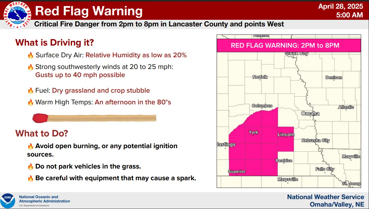
…RED FLAG WARNING IN EFFECT FROM 2 PM TO 8 PM CDT FOR WIND AND LOW RELATIVE HUMIDITY FOR SOUTHEAST NEBRASKA…
NWS
* AFFECTED AREA…Butler, Seward, Lancaster, Saline, and Jefferson Counties.
* WINDS…Southwest 20 to 25 mph with gusts up to 40 mph.
* RELATIVE HUMIDITY…As low as 22 percent.
* IMPACTS…Any fires that develop will likely spread rapidly.
Outdoor burning is not recommended.
PRECAUTIONARY/PREPAREDNESS ACTIONS…
A Red Flag Warning means that critical fire weather conditions are either occurring now or will shortly. A combination of strong winds, low relative humidity and warm temperatures can contribute to extreme fire behavior.
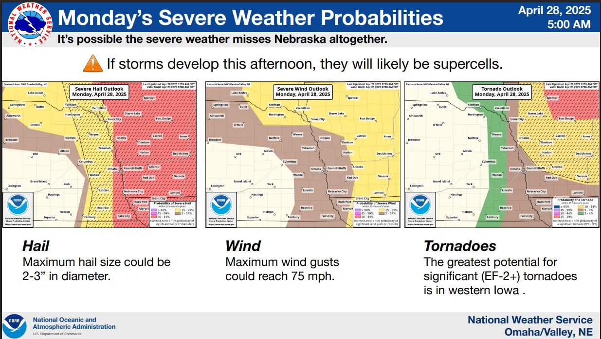
Isolated to scattered severe thunderstorms are possible this afternoon between 3 PM and 7 PM, especially along and east of a line from Sioux City to Lincoln as a dry line moves into the area.
Destructive hail up to three inches in diameter, damaging winds, and isolated tornadoes are all possible.
Detailed National Weather Service information is available here and 4-28-25 NWS AM DssPacket