


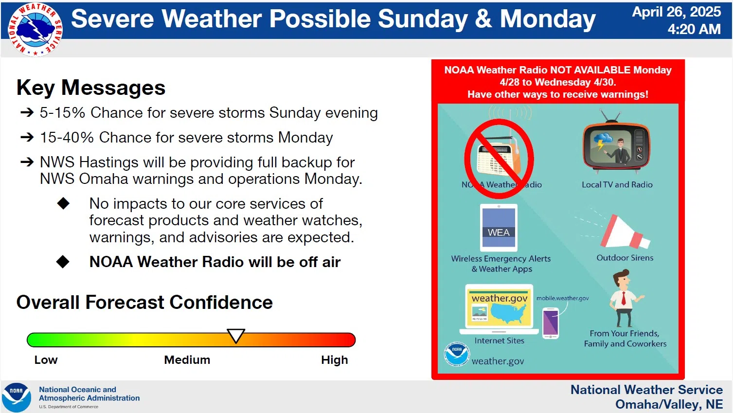
The National Weather Service has updated the chances of some severe weather developing in the area later Sunday into Monday.
The severe weather threat remains mostly unchanged for Sunday. The best chances wait until the evening across central Nebraska with redevelopment overnight as storms push northeast. Quarter-size hail, strong winds up to 60 mph, and a tornado or two are possible.
NWS
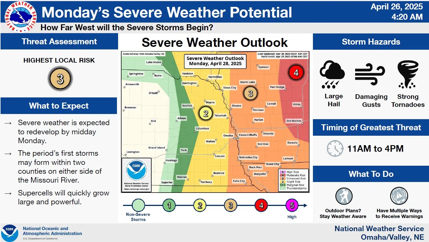
Severe storms are possible across the area on Monday, April 28th. The probability of severe weather increases from west to east as the first storms are expected to develop as early as midday.
Additional storm development is expected within two counties on either side of the Missouri River before quickly growing strong and pushing east. Large hail, damaging wind gusts, and strong tornadoes are expected to develop as the storms push into central Iowa.
Sharply warmer temperatures are expected Monday ahead of the approaching frontal boundary which will help fuel storm development.
Highs Monday are likely to be in the mid-80s with much cooler weather coming in behind the storms and temperatures on Tuesday are only expected to be in the upper 60s.
Additional information from the National Weather Service is available here and 4-26-25 0420 DssPacket
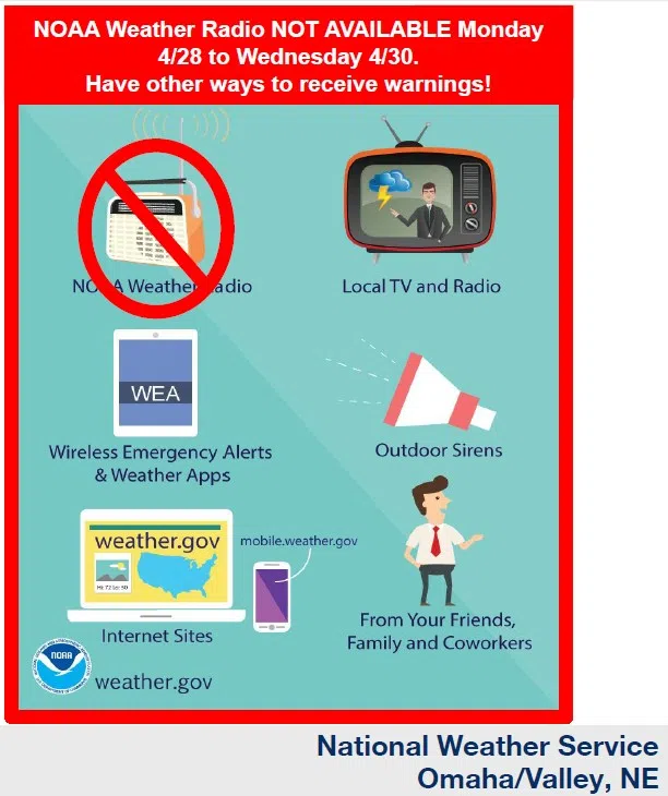
Due to a previously scheduled computer upgrade the National Weather Service radio broadcasts will be off-air Monday through Wednesday. Be sure and have other means of receiving alerts utilizing broadcast media or other sources as shown in the following graphic:
NWS