


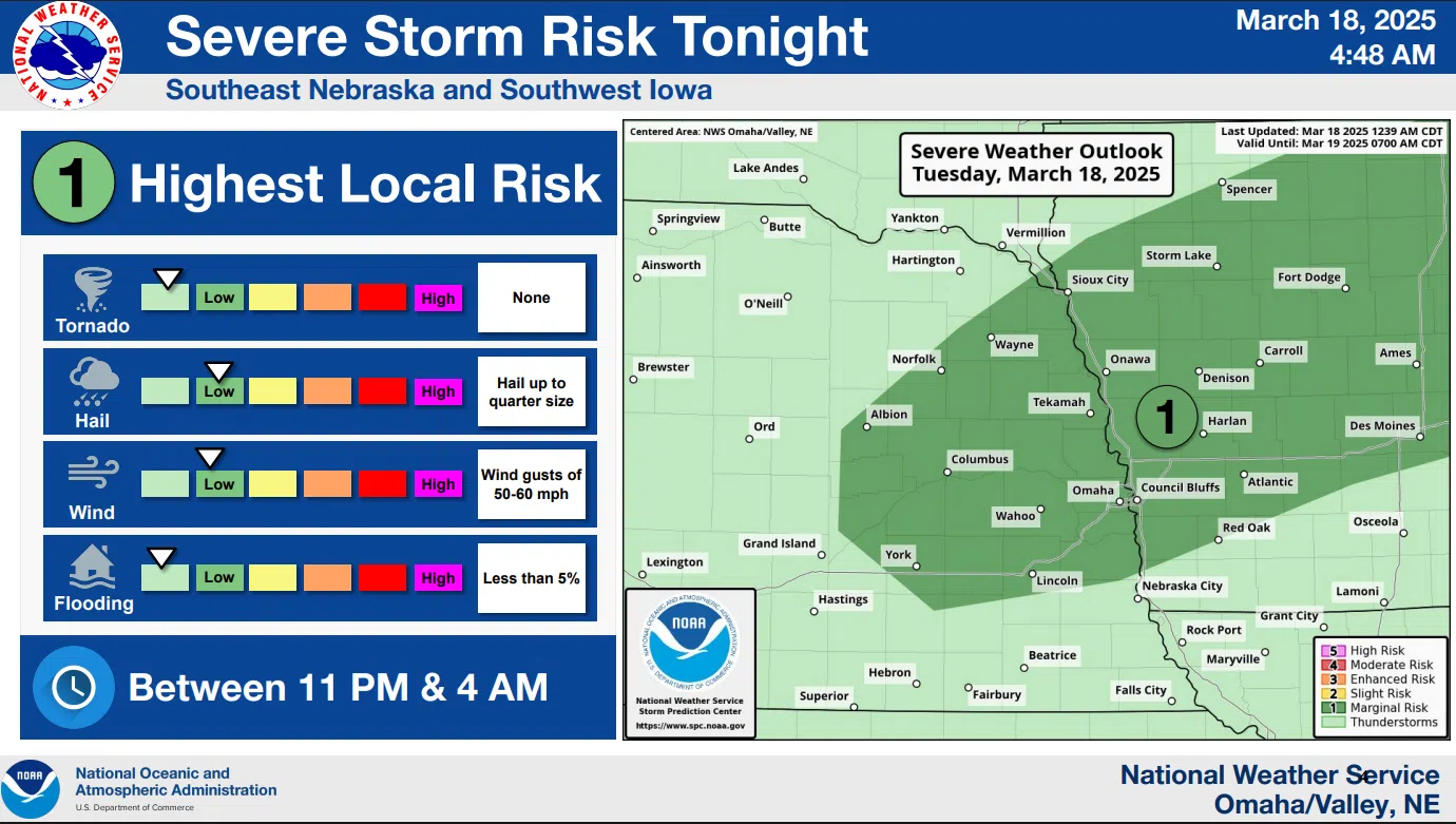
Warm and breezy is the forecast for today but big changes will take place beginning tonight.
Monday’s temperature reached a record high of 85 degrees and today’s forecast is for highs in the upper 70s to near 80.
3-18-25 NWS
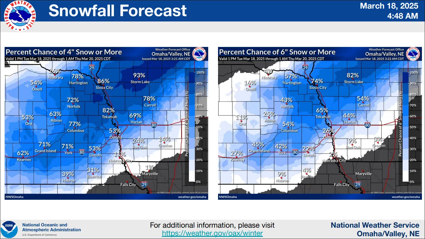
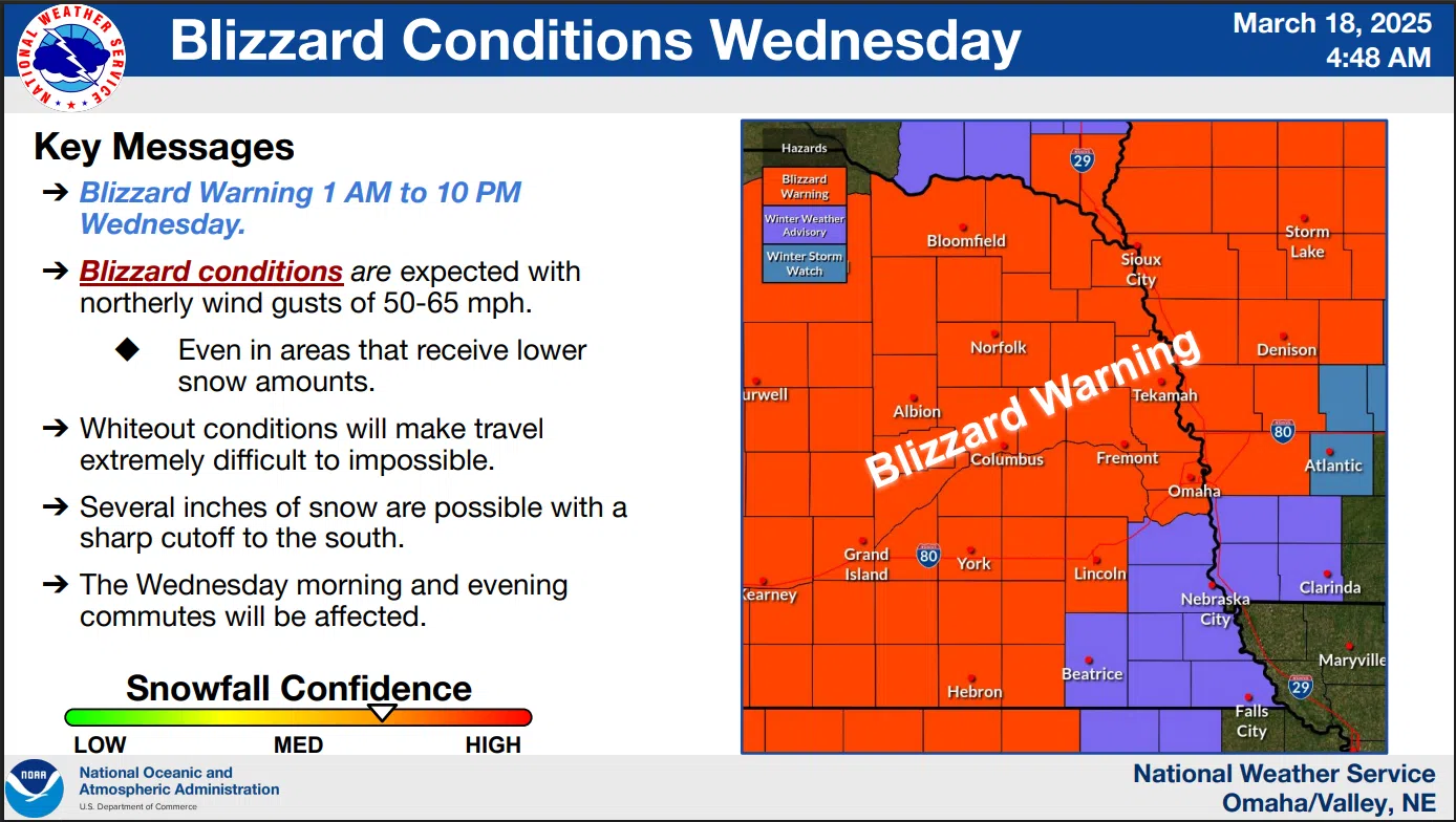
A major storm system will move in starting tonight with a chance of some severe thunderstorms before rain changes over to snow and high winds bring blizzard conditions to the area.
A HIGH WIND WARNING WILL BE IN EFFECT FROM 1 AM TO 7 PM WEDNESDAY.
North winds 30 to 45 mph with gusts up to 65 mph are expected.
3-18-25 NWS
A BLIZZARD WARNING WILL BE IN EFFECT FROM 7 AM TO 10 PM WEDNESDAY.
Blizzard conditions are expected with snow accumulations between 2 and 7 inches. Locally higher amounts are possible. Winds gusting as high as 65 mph.
Travel will be very difficult to impossible. Widespread blowing snow will significantly reduce visibility and the hazardous conditions will affect the Wednesday morning and evening commutes.
The early Tuesday morning National Weather Service detailed forecast is available here
3-18-25 NWS