


NWS
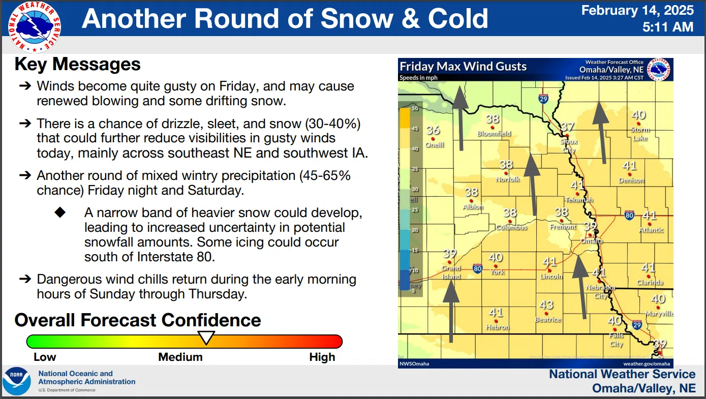
A combination of strong winds, blowing snow and a wintry mixture of precipitation will be possible today. This could create a few slick roads. Southerly winds could gust up to 45 mph, with the blowing snow possibly creating reduced visibility on east-west roads.
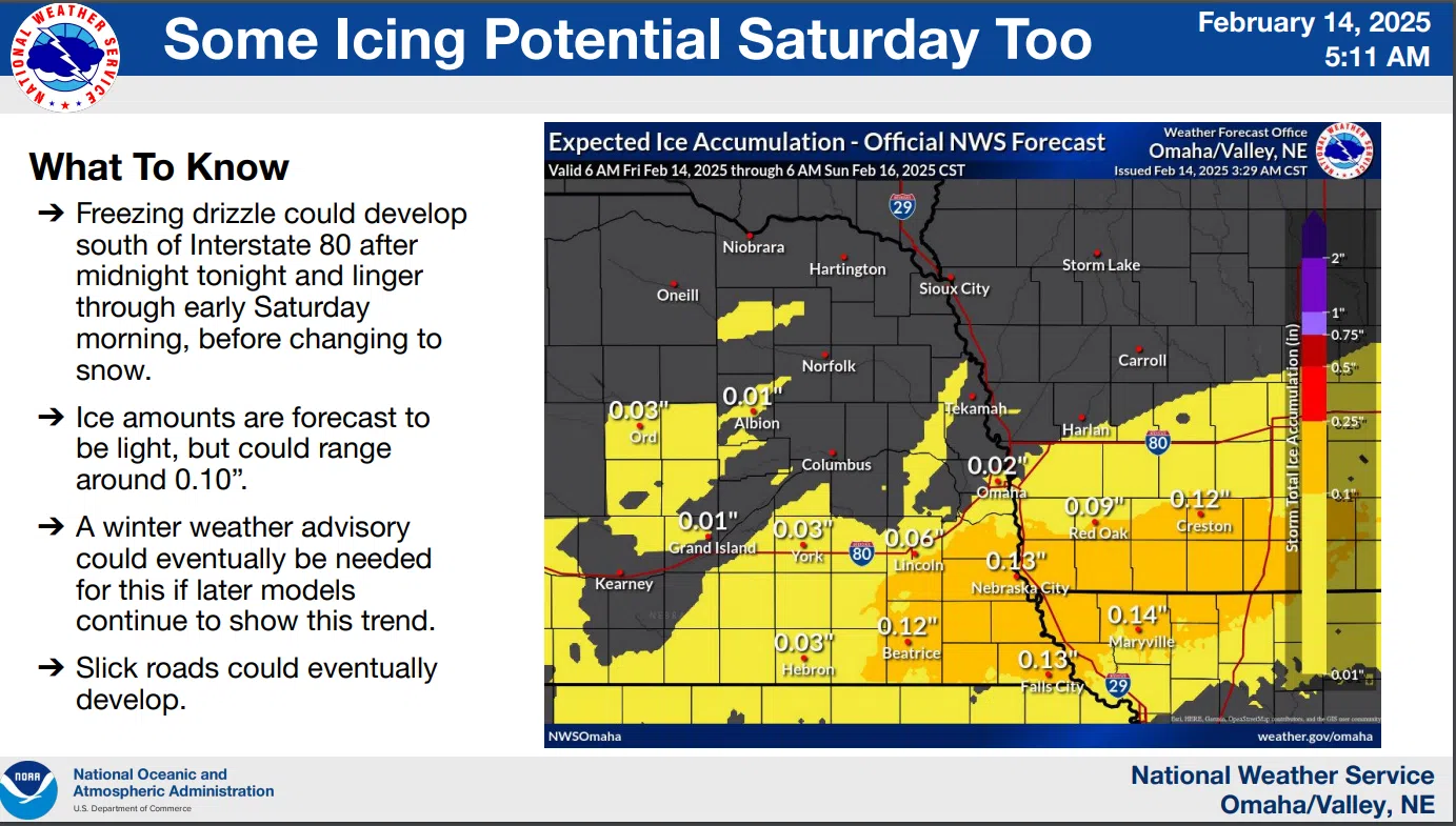
Snow could develop tonight in northeast Nebraska as a cold front moves into the region. There`s a chance of freezing drizzle south of Instate 80 with some light icing possible.
The wintry mix becomes all snow Saturday with gusty northerly winds 25 to 35 mph possible. Snow amounts of 1 to 3 inches are forecast, but there be a narrow band of locally higher amounts.
A combination of new snow as well as strong northerly winds will lead to additional blowing snow concerns through the day on Saturday into Saturday night.
Another morning of dangerous wind chills is forecast for Sunday, with wind chills of -15 to -25 forecast for the area.
More accumulating snow is likely Monday into Tuesday (50-80% chance). Amounts with the system could range 1 to 4 inches, with the highest amounts across southern Nebraska.
Even colder mornings are likely to repeat through at least Thursday, with wind chills of -20 to -35 possible each morning. Tuesday morning appears to be the coldest day. The Friday morning National Weather Service detailed outlook is available here 2-15-25 NWS AM DssPacket (1)