


The Lincoln area is likely to see a couple of rounds of snow along with bitterly cold wind chills.
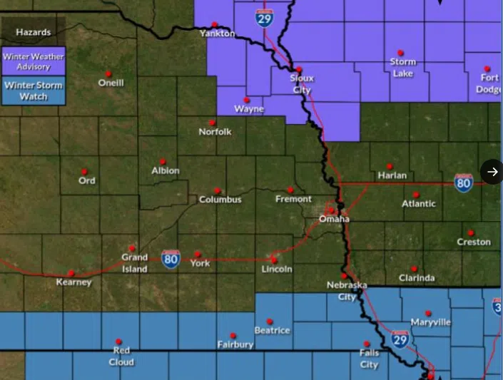
Lincoln/Lancaster County is under a Winter Storm Watch from Tuesday evening through Wednesday afternoon, according to the National Weather Service.
Meteorologist Dirk Petersen tells KLIN News the first round arrives may even arrive tonight. “We’re expecting anywhere from a trace to an inch. Fortunately it will be on the fluffier side, so nothing that’s going to be to hard to push out of the way.”
Total snow accumulations between 5 and 7 inches is possible. Some blowing snow and reduced visibility is also possible with winds gusting 20 to 25 mph to blow the very fluffy snow.
Petersen says the bigger concern is Tuesday night into Wednesday. “It’s a longer duration snow with this round and it will linger all the way through a good chunk of Wednesday.” Petersen says four inches of snow is possible for the Lincoln area.
Higher amounts are expected for areas further south where a Winter Storm Watch is in effect. Petersen says Thursday morning wind chills could make it feel like 10-15 below zero.
Roads will likely become slick and hazardous. Plan on slippery road conditions. The hazardous conditions will impact the Wednesday commutes.
Persons should consider delaying travel. If travel is absolutely necessary, drive with extreme caution. Consider taking a winter storm kit along with you, including such items as tire chains, booster cables, flashlight, shovel, blankets and extra clothing. Also take water, a first aid kit, and anything else that would help you survive in case you become stranded.