


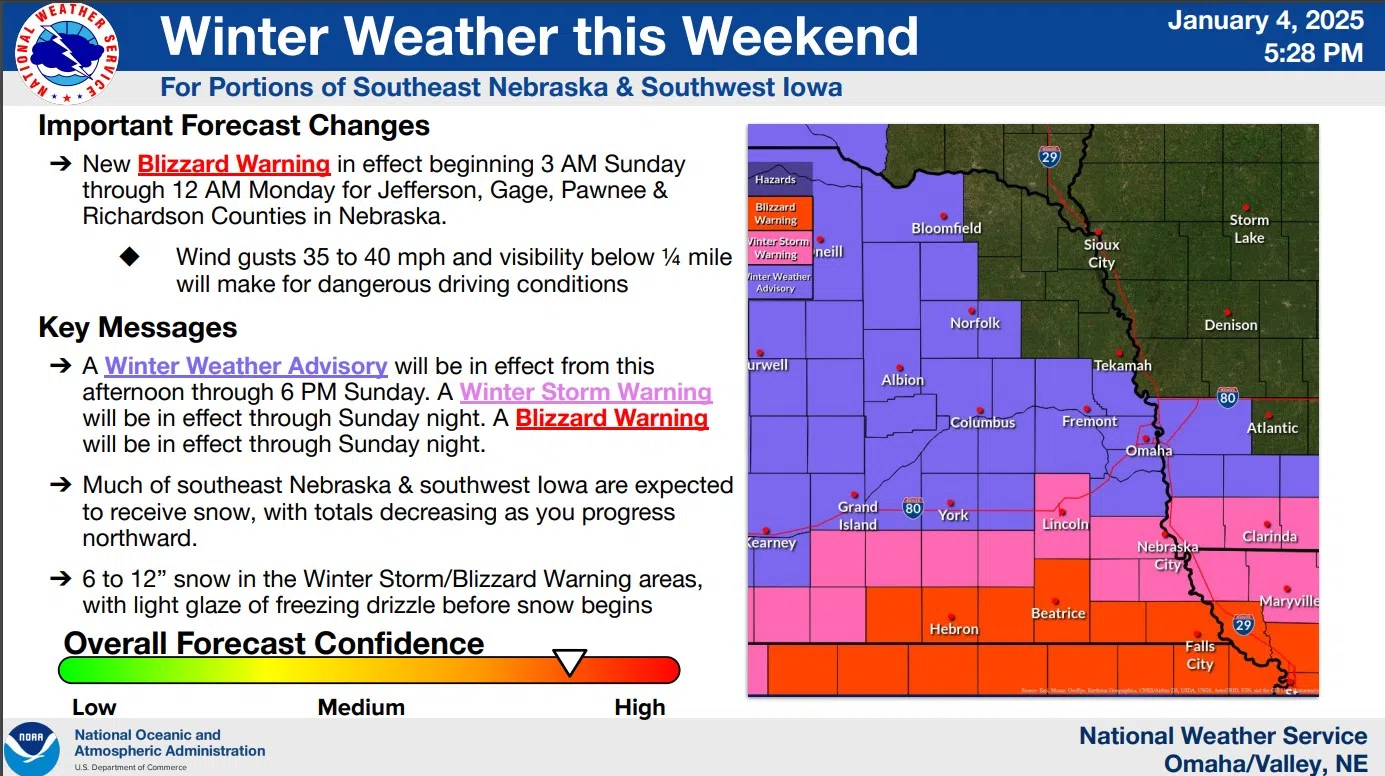
…WINTER STORM WARNING IN EFFECT UNTIL MIDNIGHT CST SUNDAY NIGHT…
The winter storm moving into Southeast Nebraska and Southwest Iowa is bringing areas of freezing drizzle and snow. Travel will become difficult due to blowing and drifting snow as the storm continues into Sunday.
NWS
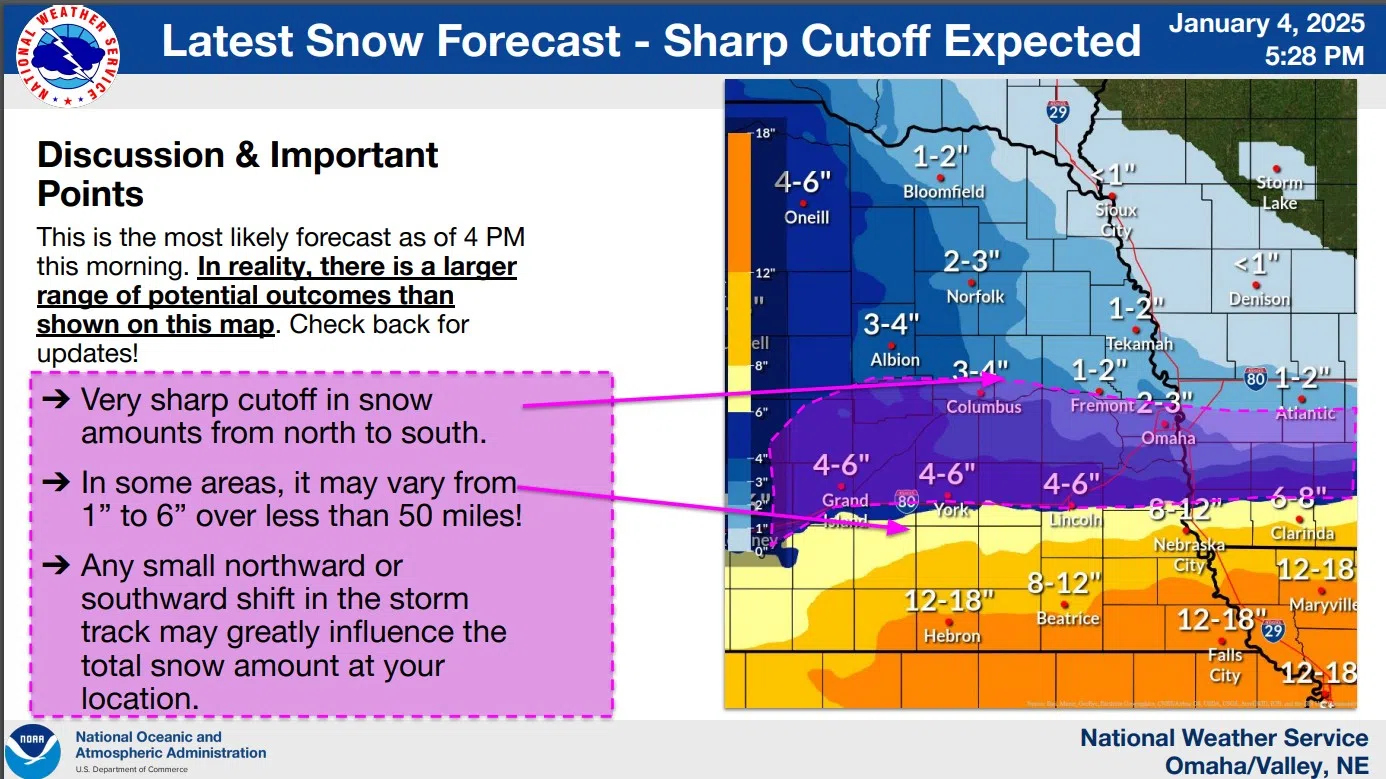
Heavy snow is forecast for southeast Nebraska and extreme southwest Iowa where storm totals of 6 to 12 inches or more are forecast.
Farther north lesser snow amounts of 0 to 4 inches are forecast.
Northerly wind gusts of 25 to 35 miles per hour will also reduce visibilities due to blowing snow and there could considerable drifting as well. Travel will remain difficult in some locations on Sunday due to blizzard conditions along the Kansas state line.
Just to the South and East of the Lincoln area Blizzard Warnings have been issued and extend into the Kansas City Metro area through early Monday morning.
Very cold conditions will move into the region as this winter storm moves out with morning wind chills of -10 to -20 possible across eastern Nebraska and southwest Iowa each morning Monday through Wednesday.
The coldest wind chills are expected across portions of northeast Nebraska, and extreme cold advisories may eventually be needed for some areas.
The latest National Weather Service detailed summary as of late Saturday afternoon is available here 1-4-25 NWS 5p DssPacket