


NWS
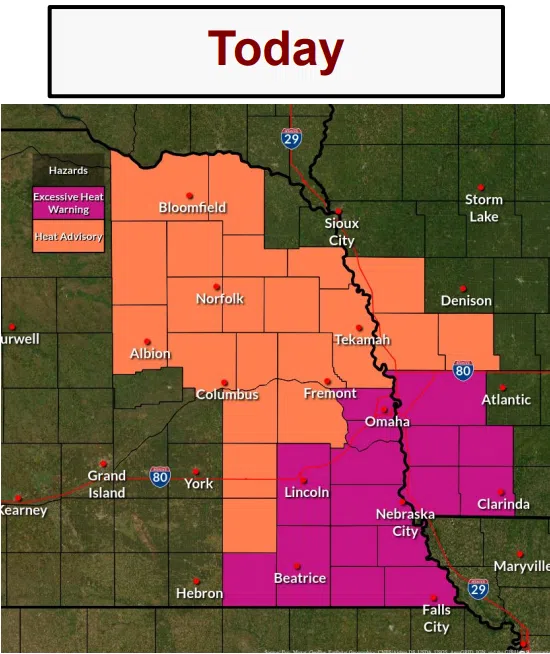
…EXCESSIVE HEAT WARNING EFFECT FROM 1 THIS AFTERNOON TO 7 PM CDT WEDNESDAY…
* WHAT…Dangerously hot conditions with heat index values up to 113 are expected.
* WHERE…Portions of southwest Iowa and east central and southeast Nebraska.
* IMPACTS…Heat-related illnesses increase significantly during extreme heat and high humidity events. Urban areas within larger cities are often even hotter than surrounding suburban and rural areas.
PRECAUTIONARY/PREPAREDNESS ACTIONS…
Drink plenty of fluids, stay in an air-conditioned room, stay out of the sun, and check up on relatives and neighbors.
Do not leave young children and pets in unattended vehicles.
Car interiors will reach lethal temperatures in a matter of minutes.
Take extra precautions when outside. Wear lightweight and loose-fitting clothing. Try to limit strenuous activities to early morning or evening. Take action when you see symptoms of heat exhaustion and heat stroke.
Forecast Details
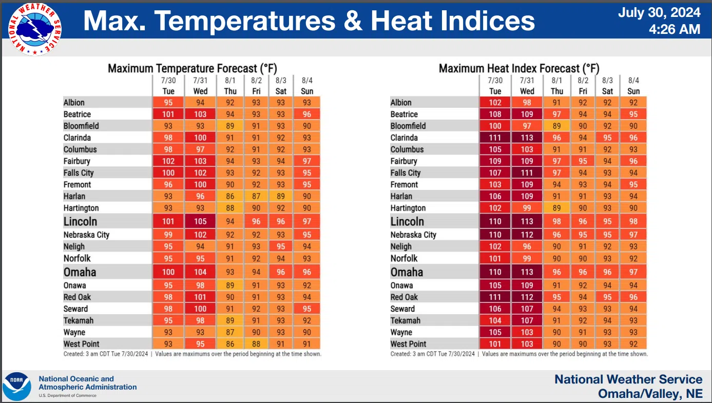
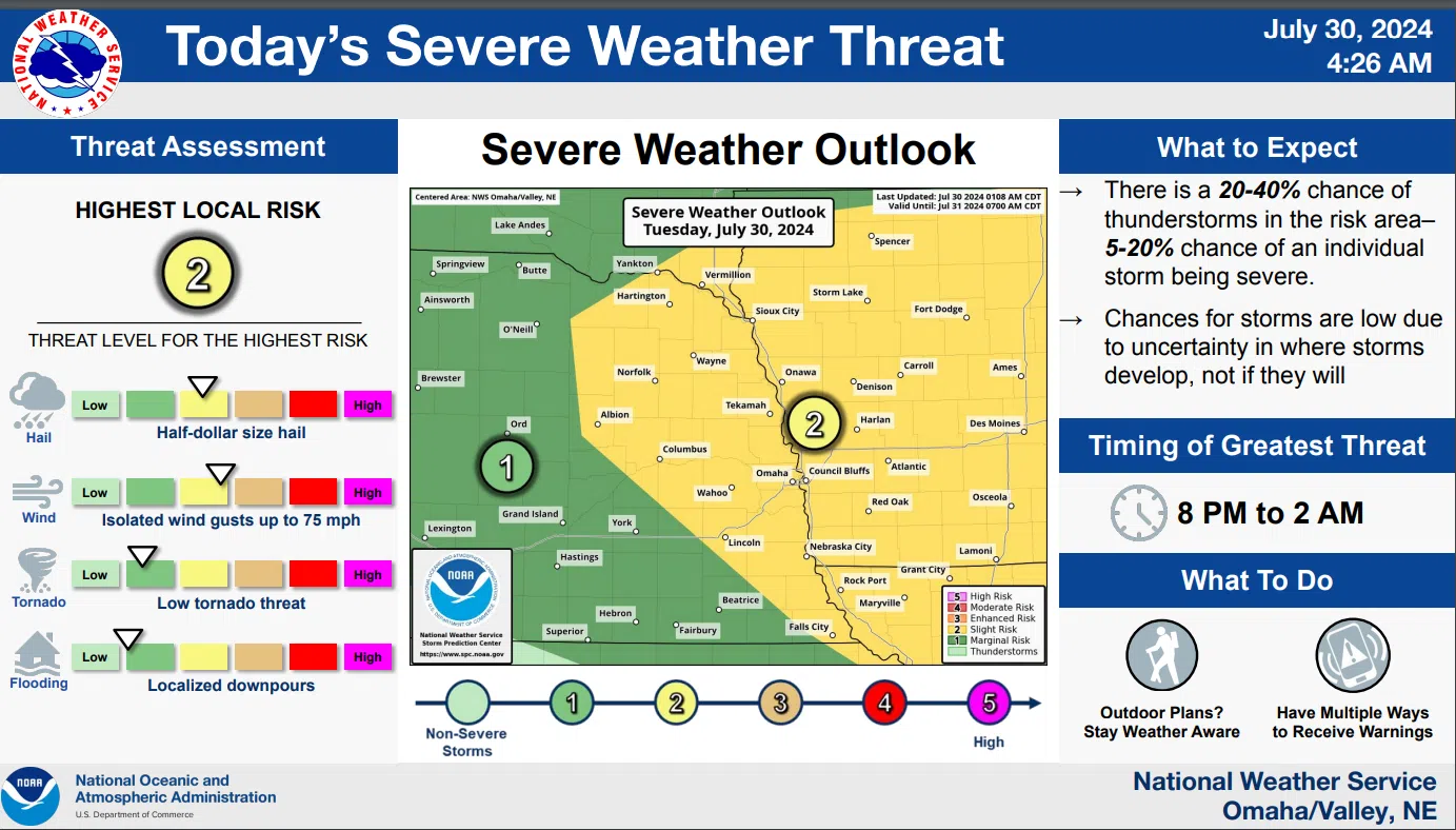
Heat index values this afternoon will range from 105 to 115 with the hottest ‘feels like’ readings across southeast Nebraska and southwest Iowa. Scattered strong to severe thunderstorms are expected late this evening into the overnight hours, with damaging winds and hail possible in the strongest storms.
Heat indicies Wednesday afternoon will range from 100 to 115 with the hottest across southeast Nebraska and southwest Iowa.
Wednesday features one of the better chances this week for strong to severe thunderstorms as a cold front moves through the region late in the day. The Tuesday AM National Weather Service Advisory is available here 7-30-24 NWS AM DssPacket
The National Weather Service Heat Risk Map is available here https://www.wpc.ncep.noaa.gov/heatrisk/
NWS