


TORNADO WATCH IS IN EFFECT UNTIL 1000 PM CDT FOR THE FOLLOWING LOCATIONS
NEBRASKA COUNTIES INCLUDED: BURT BUTLER CASS COLFAX CUMING DAKOTA DODGE DOUGLAS LANCASTER MADISON OTOE PLATTE SALINE SARPY SAUNDERS SEWARD STANTON THURSTON WASHINGTON
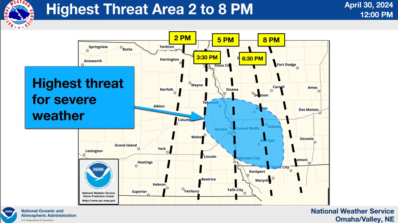
 Another round of strong to severe storms is expected this afternoon and evening across portions of eastern Nebraska and southwest Iowa. Large hail up to 3 inches in diameter and damaging winds up to 75 miles per hour are the primary threats. A few tornadoes will also be possible.
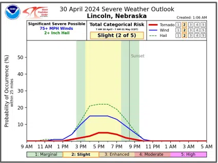
The greatest severe weather threat is expected to materialize in the 2 pm to 8 pm timeframe, generally along and east of U.S. 77.
More storms are expected beginning Wednesday afternoon and continuing through Wednesday night into Thursday morning.
The greatest severe weather threat will exist near the Kansas border, while the potential for flash flooding will encompass a larger part of eastern Nebraska and southwest Iowa.
Additional details are available here 4-30-24 NWS Early PM DssPacket