


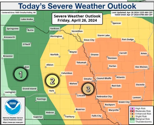
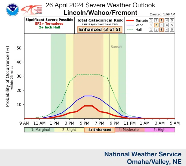
 Severe weather is likely across much of eastern Nebraska and southwest Iowa this afternoon and evening. All hazards are possible, including hail up to three inches in diameter, a few strong tornadoes, and thunderstorm winds up to 70 mph.
Much of eastern Nebraska and southwest Iowa are in an enhanced risk of severe weather. The best timeframe for severe storms should be from 2 pm through 8 pm. Be prepared to implement severe weather safety plans on Friday afternoon and evening.
Another round of severe weather is likely late Saturday afternoon into Saturday night, especially along and south of I-80. Again, all severe hazards are possible, including hail up to three inches in diameter, a few strong tornadoes, and thunderstorm winds up to 70 mph.
Severe weather is again possible Sunday afternoon into evening in parts of southeast Nebraska and southwest Iowa. Hail up to quarter size and thunderstorm winds up to 60 mph are the main hazards, but an isolated weak tornado couldn`t be ruled out that day as well. The Friday AM NWS briefing is available here 4-26-24 NWS AM DssPacket