


…HIGH WIND WARNING IN EFFECT FROM NOON TO 10 PM CDT SATURDAY…
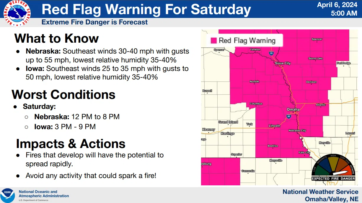
* WHAT…Southeast winds 30 to 40 mph with gusts up to 55 mph expected.
…RED FLAG WARNING IN EFFECT FROM NOON TODAY TO 8 PM CDT THIS EVENING FOR VERY STRONG WINDS AND DRY FUELS FOR EASTERN NEBRASKA.
*TIMING…Saturday Afternoon and Evening
* WINDS…Southeast 25 to 35 mph with gusts up to 55 mph.
* RELATIVE HUMIDITY…As low as 36 percent.
* TEMPERATURES…Up to 68.
* IMPACTS…Any fires that develop will spread rapidly. Outdoor burning is not recommended.
****
 A powerful weather system will move through the region this weekend. Southeast winds are expected to become quite strong with gusts of 45 to 55 mph possible Saturday afternoon into evening.
The strong winds will combine with dry fuels to create dangerous wildfire conditions during that same time. In addition to the fire weather concerns, a fast-moving band of showers and thunderstorms will advance from west to east across the area, mainly on Saturday evening.
The greatest severe weather threat will be south of a line from Columbus to Nebraska City in the 5 PM to 9 PM timeframe.
While damaging wind gusts will be the main concern, isolated hail occurrences and/or a tornado or two are also possible.
Sunday through Friday Low pressure will move across northeast Nebraska Sunday afternoon. Any storms that develop in the vicinity of the low pressure could produce a brief funnel and/or some small hail.
Additional maps and information is available here 4-6-24 NWS AM DssPacket