


A quicker end to winter weather conditions is now forecast meaning less total snow accumulation for the Lincoln area.
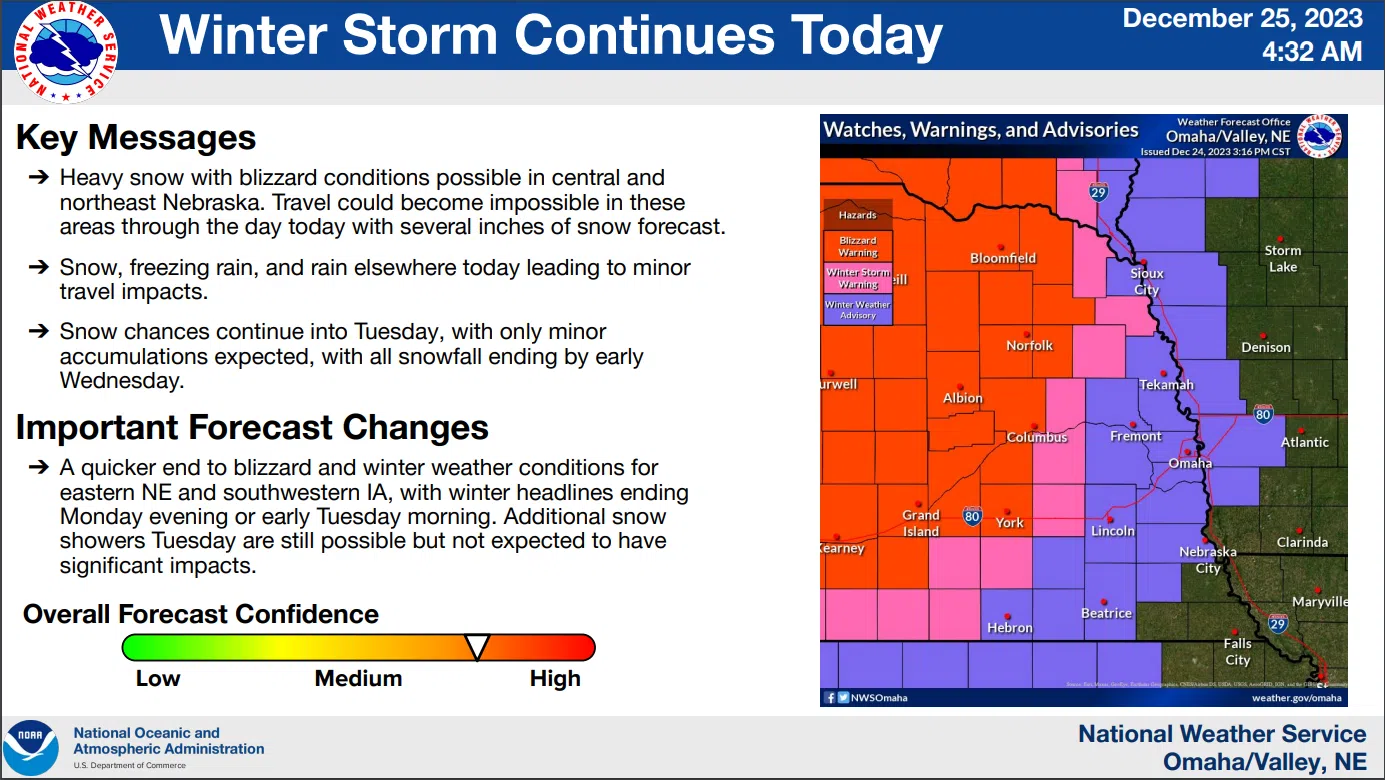
The Christmas morning National Weather Service update maps show blizzard conditions west and north of the Lincoln/Omaha area. As much as 18″ of snow is possible in the O’Neill area by Thursday morning.
Southeast Nebraska including Lincoln is now under a Winter Weather Advisory until 9 pm Christmas night. The details are shown below:
416 AM CST Mon Dec 25 2023 …WINTER WEATHER ADVISORY NOW IN EFFECT UNTIL 9 PM CST THIS EVENING…
* WHAT…Mixed precipitation. Additional snow accumulations up to 3 inches and ice accumulations around one tenth of an inch. Winds gusting as high as 40 mph.
* WHERE…Portions of southwest and west central Iowa and east central and southeast Nebraska.
* IMPACTS…Plan on slippery road conditions. The hazardous conditions could impact the Monday morning and evening commutes.
PRECAUTIONARY/PREPAREDNESS ACTIONS… Be prepared for slippery roads. Slow down and use caution while driving. If you are going outside, watch your first few steps taken on stairs, sidewalks, and driveways. These surfaces could be icy and slippery, increasing your risk of a fall and injury.
The latest NWS Briefing maps are available here 12-25-23 NWS AM DssPacket