


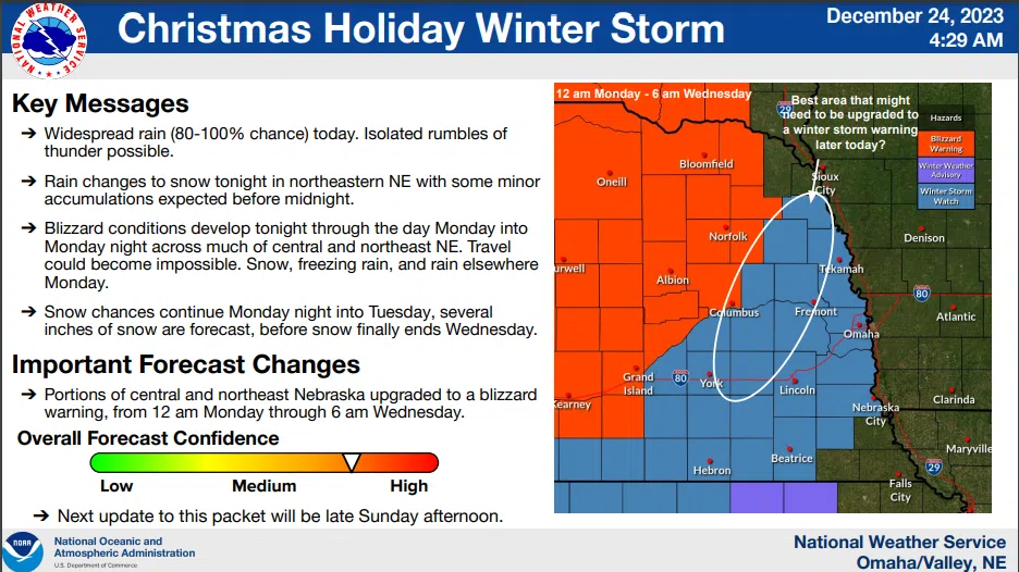
The early Sunday morning advisory from the National Weather Service indicates the approaching winter storm is intensifying and expanding further to the south and east.
Rain may mix with light snow Sunday afternoon with little to no accumulation expected. The main, significant storm system will affect the region beginning Sunday night.
Accumulating snow is likely, especially across northeast Nebraska where blizzard or near-blizzard conditions could develop. Some minor ice accumulation is also possible on Sunday night. There is a high probability of travel being affected by this storm system. Snowfall and wind begin to taper on Tuesday.
The NWS Winter Storm Watch:
…WINTER STORM WATCH REMAINS IN EFFECT FROM LATE TONIGHT THROUGH LATE TUESDAY NIGHT…
* WHAT…Heavy mixed precipitation possible. Total snow and sleet accumulations between 2 and 9 inches and ice accumulations around a light glaze possible. Winds could gust as high as 45 mph.
* WHERE…Portions of east central, northeast, and southeast Nebraska.
* WHEN…From late tonight through late Tuesday night.
* IMPACTS…Travel could be very difficult. The hazardous conditions could impact the Monday morning and evening commutes. Gusty winds could bring down tree branches.
PRECAUTIONARY/PREPAREDNESS ACTIONS… Monitor the latest forecasts for updates on this situation. Persons should consider delaying all travel. If travel is absolutely necessary, drive with extreme caution. Consider taking a winter storm kit along with you, including such items as tire chains, booster cables, flashlight, shovel, blankets and extra clothing. Also take water, a first aid kit, and anything else that would help you survive in case you become stranded.
Additional information with maps is available here 12-24-23 NWS AM DssPacket