


 This Afternoon and Tonight
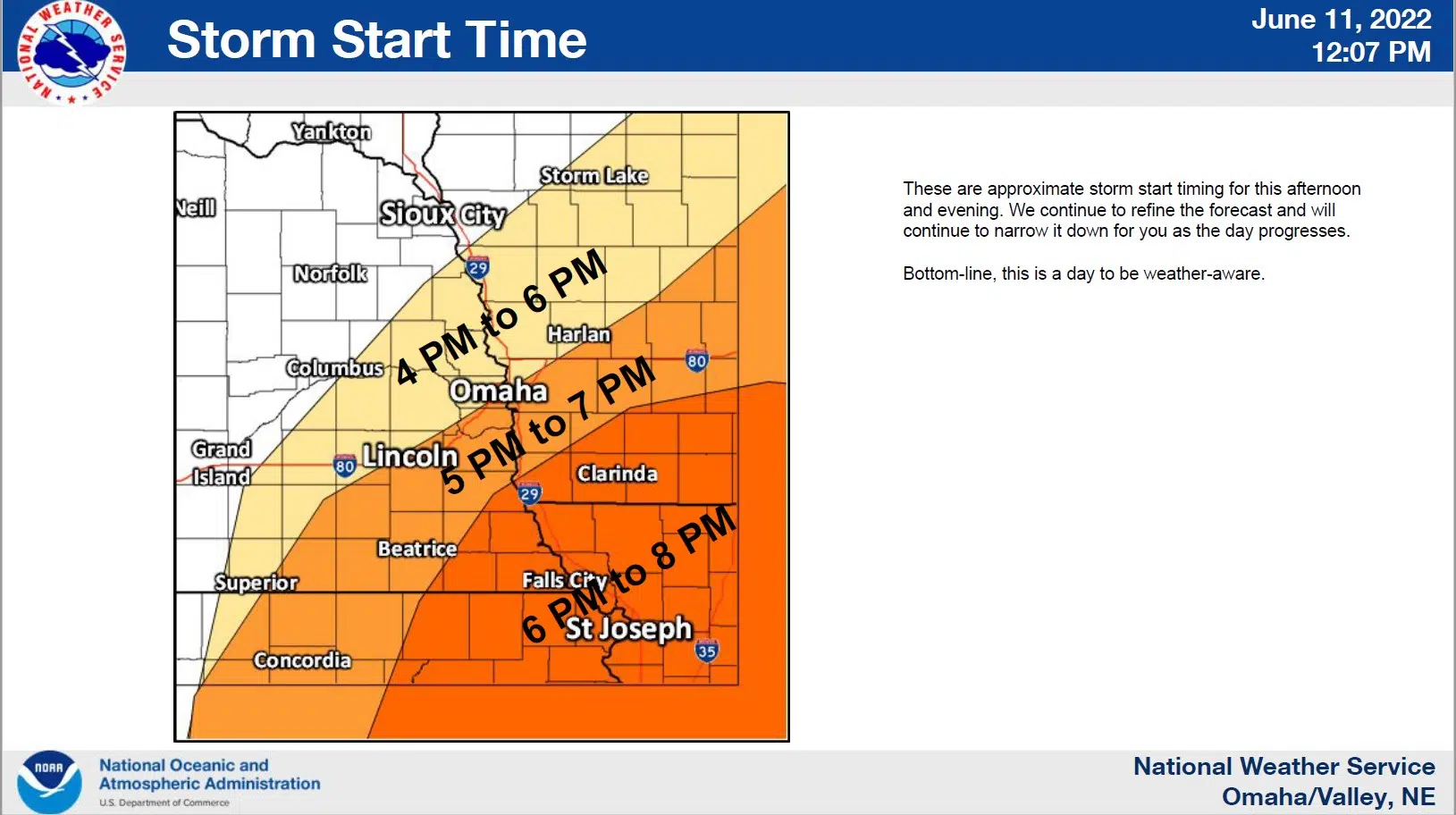
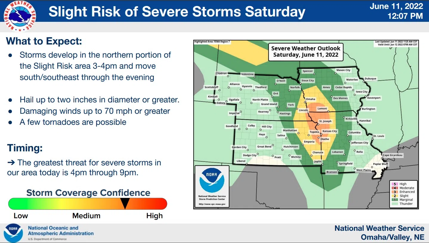
Thunderstorm chances return this afternoon and evening with severe storms possible mainly south of the I-80 corridor. Large hail will be the primary threat.
A few storms will also be capable of producing tornadoes and damaging winds.
Sunday through Friday
There is a chance for thunderstorms Sunday night and again Tuesday night and Wednesday. Sultry conditions are expected Sunday through Tuesday.
It appears Monday will be the hottest day with highs anywhere from 96 to 102 degrees and heat indicies approaching 109 degrees in some locations.
Additional information on the possible severe weather and next week’s heat and heat index possibilities is available here 6-11-22 NWS DssPacket