


…WIND ADVISORY IN EFFECT FROM 7 AM THIS MORNING TO 9 PM CDT THIS EVENING…
 * WHAT…Northwest winds 25 to 35 mph with gusts up to 50 mph are expected.
* WHERE…Portions of east central and southeast Nebraska and southwest Iowa.
* IMPACTS…Gusty winds could blow around unsecured objects. Tree limbs could be blown down and a few power outages may
result.
Use extra caution when driving, especially if operating a high profile vehicle. Secure outdoor objects.
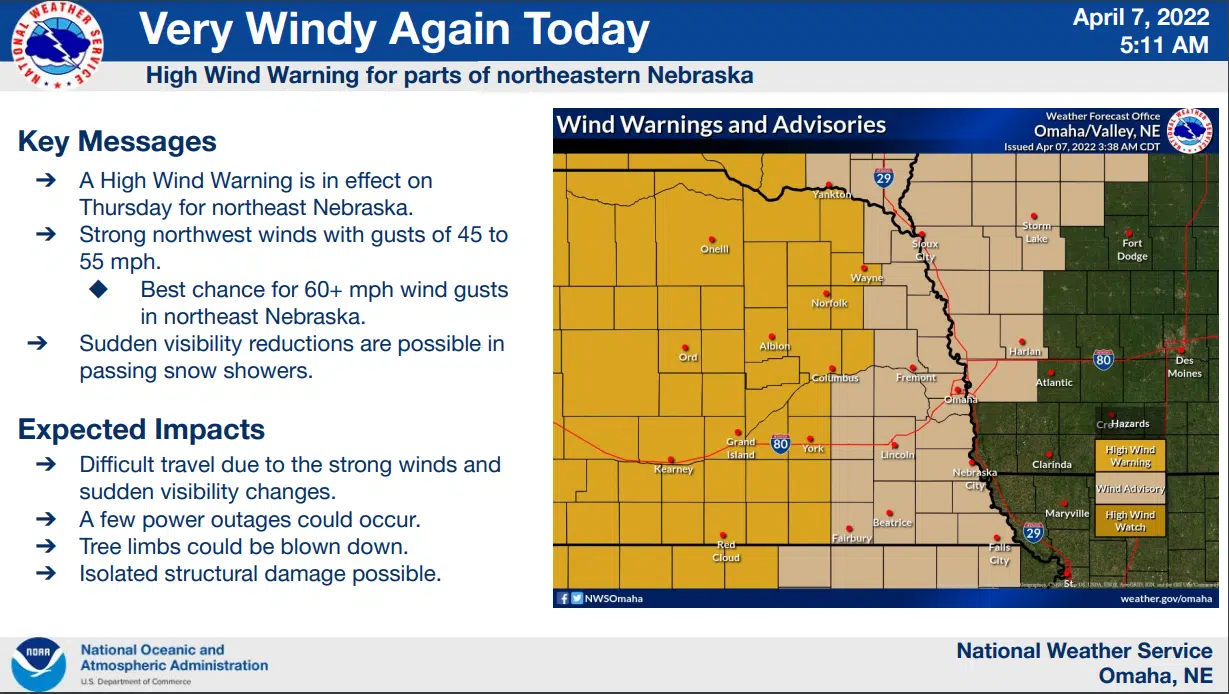
More Forecast Information and Maps are available here 4-7-22 IDSS_Packet_-_NWS_Omaha
…FIRE WEATHER WATCH IN EFFECT FROM FRIDAY AFTERNOON THROUGH FRIDAY EVENING FOR WIND AND LOW RELATIVE HUMIDITY FOR EASTERN NEBRASKA…
The National Weather Service in Omaha/Valley has issued a FireWeather Watch for wind and low relative humidity, which is ineffect from Friday afternoon through Friday evening.
* Affected Area…In Nebraska, Antelope, Boone, Madison, Platte, Colfax, Butler, Seward, Lancaster, Saline, Jefferson and Gage.
* Winds…North 15 to 25 mph with gusts up to 30 mph.
* Relative Humidity…As low as 18 percent.
* Impacts…Any fires that ignite may spread rapidly and exhibit extreme fire behavior.
PRECAUTIONARY/PREPAREDNESS ACTIONS… A Fire Weather Watch means that critical fire weather conditions are forecast to occur. Listen for later forecasts and possible Red Flag Warnings.