
A major change in weather is expected at the start of the week.
Today and Tonight – High to very high rangeland fire danger is expected this afternoon. Temperatures will be very mild.
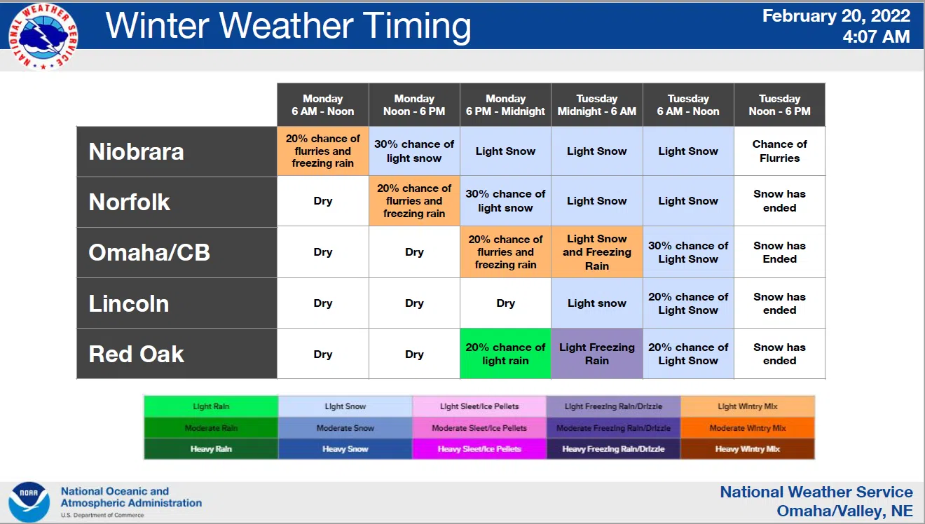
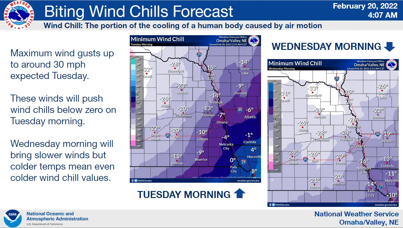
Monday through Saturday – A significantly colder air mass will overspread the region on Monday with the cold persisting through much of the upcoming week. Dangerous wind chills are expected to develop during the nighttime hours from Monday night through Thursday night, especially over northeast Nebraska.
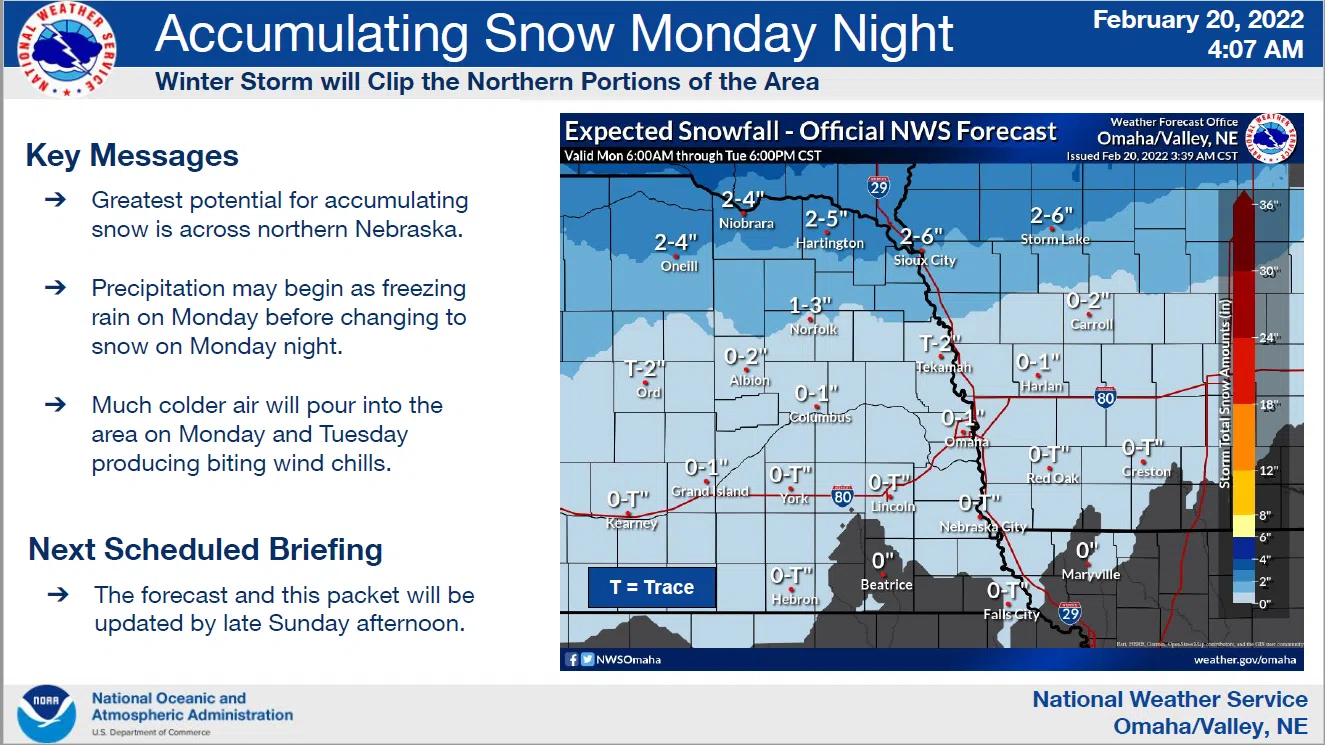
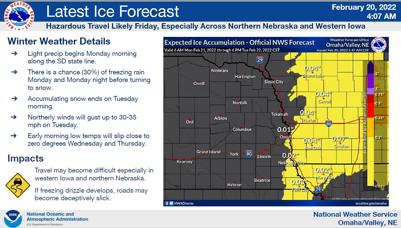
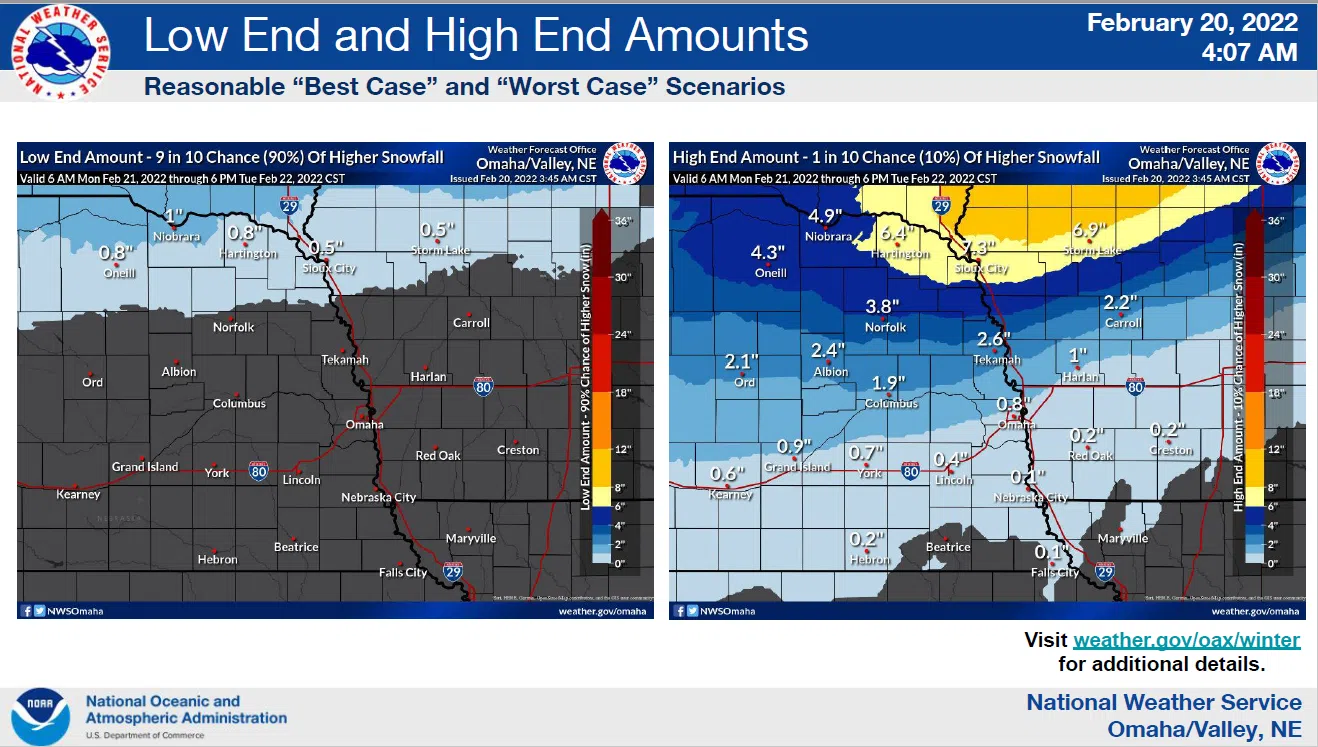
A weather system will bring a chance of light snow and possibly some light freezing drizzle to the region from Monday afternoon through Tuesday.
Travel impacts are likely, from accumulating snow in northeast Nebraska Monday night and Tuesday, and from light icing, especially in southwest Iowa. Another storm system could bring accumulating snow to the region on Thursday.
The latest summary from the National Weather Service is available here IDSS_Packet_-NWS_Omaha