


 FRIDAY AFTERNOON UPDATE
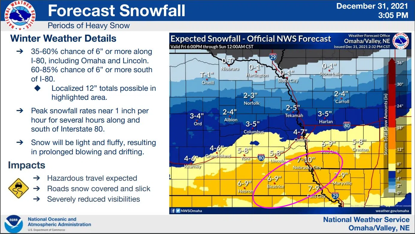
The approaching winter storm is being tracked by National Weather Service meteorologists and as the system continues to move towards the region more definitive forecasts are coming out with a slight uptick in the possible snow amounts for the Lincoln-Lancaster County Area.
In addition this afternoon, the NWS has issued a Wind Chill Advisory and a Winter Weather Advisory for areas North of the Winter Storm Warning Area.
Even so, most of Southeast Nebraska will experience sharply colder temperatures and increasing winds causing wind chills to drop to around 20 degrees below zero overnight Saturday.
The Nebraska Department of Transportation and the Nebraska State Patrol advise motorists to avoid or limit travel during the storm but if you must travel they be prepared.
The Winter Storm Warning Goes Into Effect at 3 AM Saturday and runs until Midnight Saturday night.
The Mid-Afternoon Friday maps and details from the National Weather Service can be accessed here OAX_Dec_31_2021_2104_UTC_dssPacket
*****
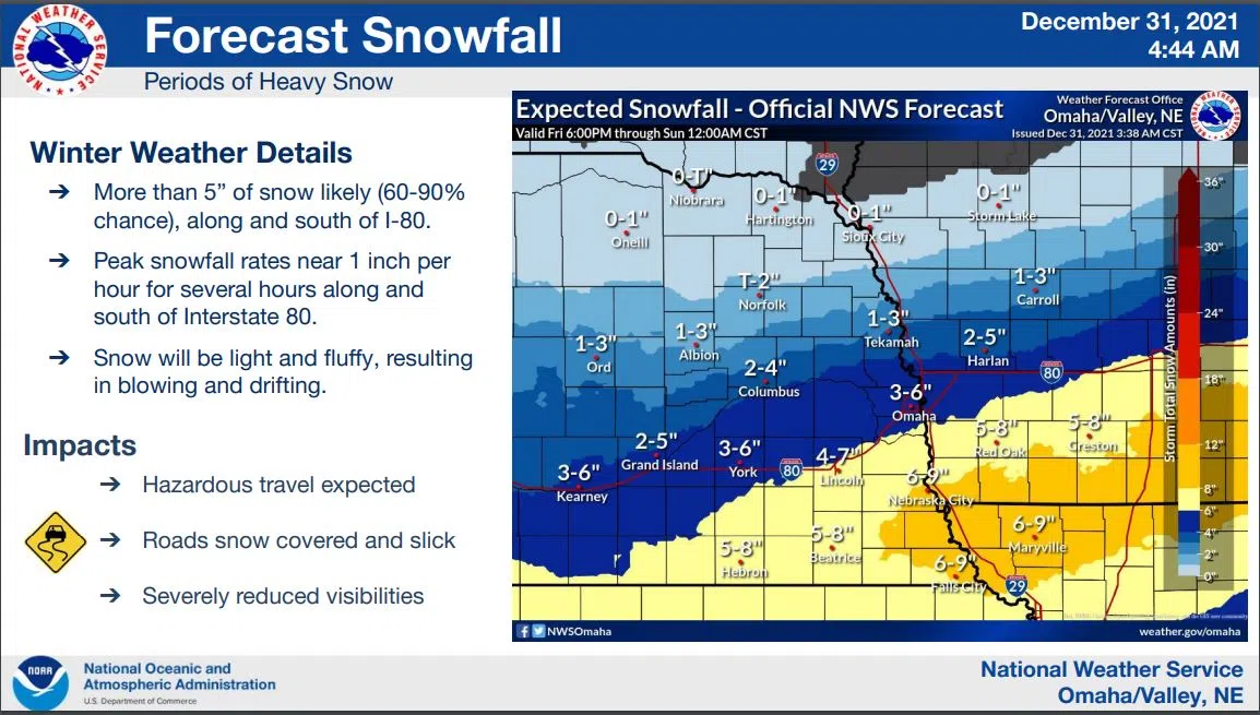
EARLY FRIDAY AM
Snow and bitterly cold temperatures are expected this weekend. Wind chill values will drop to 20 below to 30 below early Saturday morning and a Wind Chill Advisory is in effect for portions of the area in that time period.
Snow is forecast from late Friday night into Saturday afternoon with 2 to 4 inches along a line from Albion to Columbus to Tekamah to Onawa, Iowa.
Accumulations along I-80 will range from 4 to 8 inches.
Parts of far southeast Nebraska and far southwest Iowa can expect 6 to 10 inches. Travel will be impacted.
Gusty winds will accompany the snow leading to reduced visibilities and bitter winds chills. Winds chill readings will remain at 10 below or colder through Sunday morning.
 …WINTER STORM WARNING IN EFFECT FROM 3 AM SATURDAY TO MIDNIGHT CST SATURDAY NIGHT…
Heavy snow is expected with total snow accumulations of 4 to 8 inches. Winds gusting as high as 35 mph across portions of east central and southeast Nebraska from 3 AM Saturday to midnight CST Saturday night.
Travel could be very difficult. The cold wind chills as low as 25 below zero could cause frostbite on exposed skin in as little as 30 minutes.
Blowing and drifting snow will reduce visibility and create treacherous travel conditions.
If you must travel, keep an extra flashlight, food, and water in your vehicle in case of an emergency. The latest road conditions for the state you are calling from can be obtained by calling 5 1 1.
The latest update from the National Weather Service is available here OAX_Dec_31_2021_1044_UTC_dssPacket